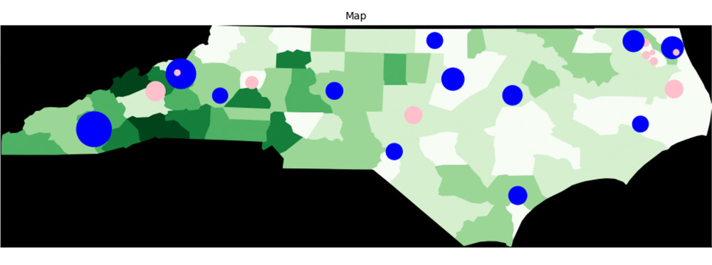
Initializes a spatial model with arbitrary polygonal patches, which are added one at a time afterward with the add() method. This coordinate system can be instantiated with model.spatial(geometry='geo'), and requires Shapely in order to function. Patches are stored in a one-dimensional list, and can be accessed by patch name (e.g. model.patches['ROWAN']) or by ID.
Initialization Parameters
wrap — bool|tuple(bool,bool), required
Whether the map wraps along the horizontal or vertical axes, or both.
corners — bool|float, optional
Whether patches touching at a single point should be neighbors, and if so, what weight.
Default value: True
offmap — bool, optional
Whether agents can take a
positionwith no patch underneath.Default value: False
Methods
Click a method name for more detailed documentation.
add( shape, name )
Adds a polygonal patch to the map.
at( x, y )
Returns the patch at the specified coordinate.
revive( coords )
Reinstates a dead patch.
neighbors( model )
Establishes the spatial network among the patches after initialization. This function is registered automatically as a
modelPostSetuphook during spatial setup and should not be called by user code.place( patch )
Organizes
Patchobjects within the Patches object. Takes a patch object when created byAgents.initialize(), places it in the appropriate list, and assigns itspositionproperty.
Object Properties
offmap — bool
Whether agents can enter areas of the map with no patch. If
Falseand an agent tries tomove()to a coordinate with no patch, the move will fail and a warning will be raised. Set from theoffmapargument ofmodel.spatial().Initial value: False
boundaries — tuple(tuple(int,int), tuple(int,int))
A tuple of tuples with the maximum and minimum coordinates that agents can take, given the grid dimensions.
((xmin, xmax), (ymin, ymax)).corners — bool|float
Whether the
'spatial'network includes patches connected only by a corner. Corresponds to thecornersargument ofmodel.spatial().Initial value: False
wrap — tuple(bool, bool)
Whether each respective dimension wraps around beyond the limits of
boundaries.dim — tuple(int, int)
The (x,y) dimensions of the grid.
Static Properties
geometry — str
The name of the patch geometry, to be set by subclasses.
Initial value: ''
charwick
May 30, 2023 at 2:25Patches can be imported from GeoJSON files, along with others, using the Geopandas package.